
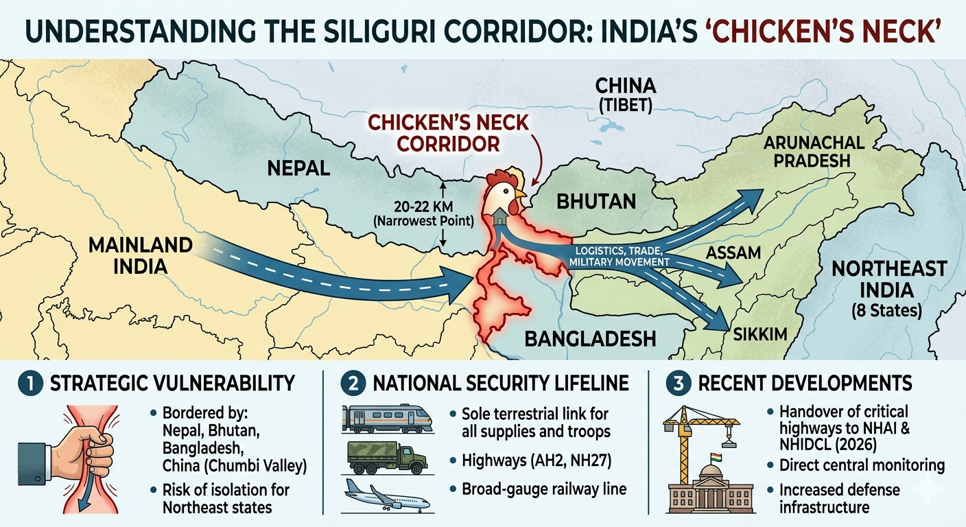
What is it ?
The Siliguri Corridor — known as the “Chicken’s Neck” — is the narrow land bridge connecting India’s eight northeastern states with the mainland, bounded by Nepal, Bhutan, Bangladesh, and China’s Chumbi Valley. [Dras](https://dras.in/chickens-neck-a-vulnerable-strategic-chokepoint-of-india/) It is only 20–22 km wide at its narrowest point and is the sole land route for highways, railways, oil pipelines, and electricity grids linking the Northeast to the rest of India.
Why Does It Matter?
The corridor is the logistical backbone for around 45 million people and a crucial supply route for the Indian military. Its narrowness makes it vulnerable to blockades during conflicts, and its proximity to multiple international borders adds to its sensitivity.
The Big News
For nearly a year, highway projects here were stuck due to a deadlock between the previous West Bengal state government and New Delhi. New CM Suvendu Adhikari resolved this within just ten days of taking oath on May 9, clearing the transfer of seven national highway sections to NHAI and NHIDCL.Key roads including NH-31, NH-33, and NH-312 go to NHAI, while NHIDCL takes over the Sevok–Coronation Bridge stretch, Hasimara–Jaigaon route, and Changrabandha corridor. In total, around 120 acres of land have been handed over to central agencies. Officials expect this to finally accelerate several long-delayed infrastructure and security projects in India’s most strategically sensitive corridor.